S-57 Electronic Navigational Chart Development Engine
The ECDIS SDK (for EXE) is an electronic chart development toolkit that complies with the S-57 data and S-52 display standards established by the International Hydrographic Organization (IHO). Based on proprietary core rendering algorithms, it provides clear and exceptional rendering performance for S-57 data, even on high-resolution screens or touchscreens.
Download|
SUPPORTED PROGRAMMIMG C++ (Qt\vs) C# (windows) python |
SUPPORTED OPERATING SYSTEMS windows centos Ubuntu Red Hat Other embedded systems |
PERFORMANCE INDEX import speed for a single map <50ms Map display speed<50ms Support loading thousands of maps |
|
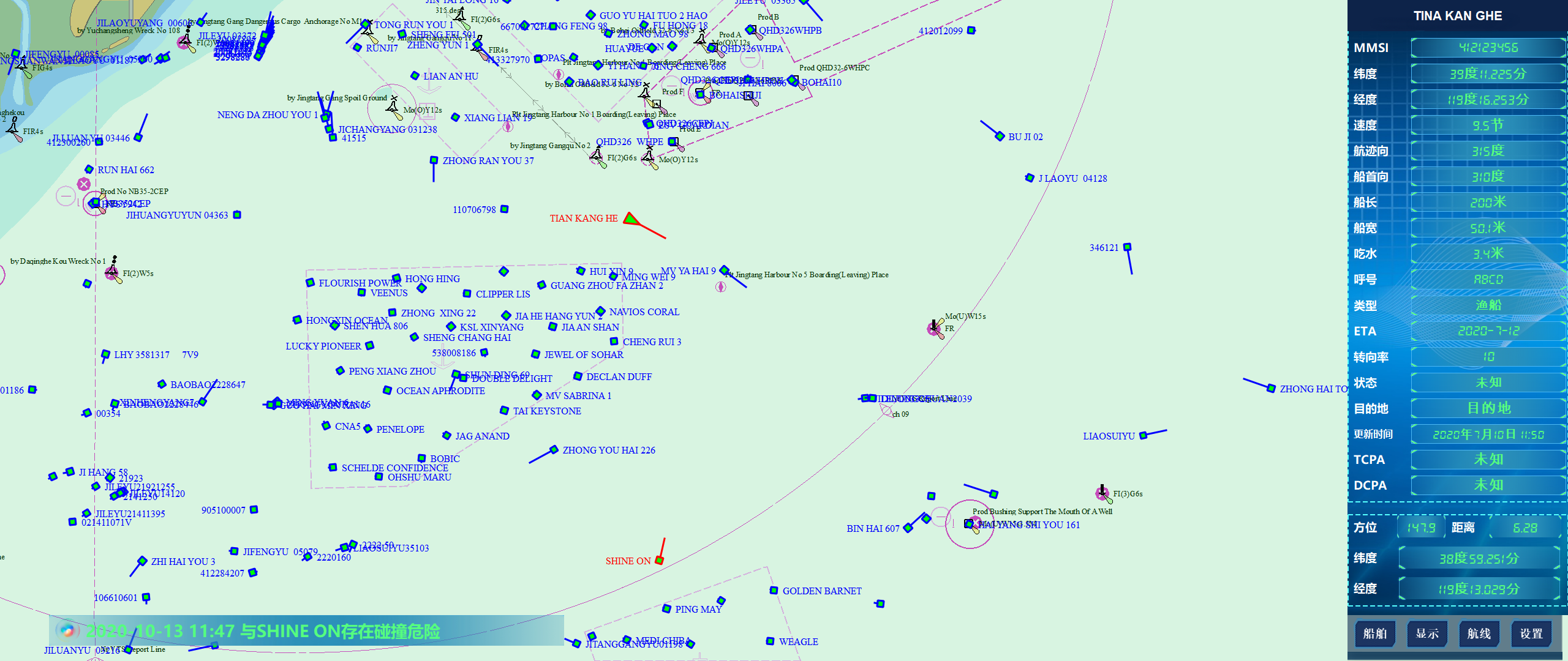
MAJOR FUNCTION (1) Import of nautical chart files (2) Splicing of nautical chart files (3) Deleting nautical charts (4) Selection of display mode for nautical charts (5) Language selection (6) Text display (7) Symbol settings (9) Color selection for nautical charts (10) Selection of Chart Objects (11) Geographic computing functions and interfaces (12) Overlay of any layer (13) Customize colors and icons (14) Chart file conversion (15) Drawing of flight routes (16) Access to various types of ship navigation equipment, including AIS, radar, compass, meteorological sensors, depth sounders, and odometry |
||